









































ICT-Based Monitoring of Climate Change-Related Deforestation: The Case of INPE in the Brazilian Amazon
Universidade Federal de Minas Gerais
"PRODES and DETER are two satellite-based monitoring systems used for policymaking and law enforcement in the Brazilian Amazon which aim to curb deforestation and, hence, reduce emissions. Over the years the information from these systems has provided a key common ground for policy debates between agencies of the Brazilian government, environmental NGOs and scientists, thus helping the efforts to track and address climate change. (Copyright: University of Manchester)"
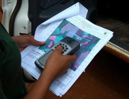
This case study, originally published by the University of Manchester, United Kingdom (UK)'s "Climate Change, Innovation and ICTs [information and communication technologies]" research project, funded by Canada's International Development Research Centre (IDRC) and managed by the University's Centre for Development Informatics (CDI), describes PRODES (programme for calculating deforestation in the Amazon), created in 1988 by the Brazilian Institute for Space Research (INPE), to produce a yearly estimate of the total area of forest loss in square kilometres based on satellite images which generate a geo-referenced map, and DETER (deforestation detection in real time), a satellite-based monitoring system, developed in 2004 that detects deforestation every 15 days and provides monthly estimates from images obtained from sensors on board satellites. Generally, PRODES is used for advocacy in debating policy changes on maintaining the forest, while DETER is used to evaluate the outcome of actions on a monthly basis and guide law enforcement actions in the forest.
"Monitoring systems based on advanced ICT play a key role in tackling climate change by allowing policy makers and other policy stakeholders to make informed choices about strategies to curb greenhouse emissions. But in order for a monitoring system to be useful in policy making it has to be accepted as trustworthy by the different groups involved." Lack of agreement between scientists, environmentalists, and politicians concerning the correct figures for the total deforestation in the Brazilian Amazon was a cause for delay in forming environmental policies, until a World Bank freeze in the payment of loans to Brazil, caused by concern for lack of forest protection and use policies, inspired the government to produce figures on deforestation through satellite imagery in the late 1980's on a yearly basis. Scientists and environmentalists then lobbied successfully for the publication of these maps on the internet.
Benefits of the systems include:
- Collaboration among scientists inside and outside the INPE.
- Construction of trust around PRODES deforestation figures as independent studies corroborated the data and led to use in academic publications and policy reports.
- Strengthening of trust in INPE as a transparent institution and increased centrality of its role in policy.
- Policy changes including increase in the legal reserve (the compulsory portion of preserved land within total institution private lands) in the Amazon from 50 to 80% in 1996; the creation of the plan to protect and control deforestation in the Amazon (PPCDAM) in 2004; the creation of decree 6321/2007 limiting bank credit to farmers in the region; and the expansion of protected areas.
Based on the examination of the history of PRODES and DETER, the environmental monitoring systems should:
- Ensure information provision connects to decision making and action.
- Separate information provision responsibilities from decisionmaking responsibilities.
- Make data freely available.
- Find ways to close design-reality gaps.
View a video on Raoni Rajão's work and read more of his papers here. For example, see:
- Rajão, R. (2012). Representations and Discourses: The Role of Local Accounts and Remote Sensing in the Formulation of Amazonia's Environmental Policy. Environmental Science & Policy.
- Rajão, R., Azevedo, A., & Stabile, M. C. C. (2012). Institutional Subversion and Deforestation: Learning Lessons from the System for the Environmental Licensing of Rural Properties in Mato Grosso. Public Administration and Development, 32(1), 229-244.
- Hayes, N., & Rajão, R. (2011). Competing Institutional Logics and Sustainable Development: The Case of Geographic Information Systems in Brazil's Amazon Region. Journal of Information Technology for Development, 17(1), 4-23.
Email from Richard Heeks and Angelica Ospina to The Communication Initiative on February 26 2012; email from Raoni Rajão to The Communication Initiative on February 26 2012 and March 19 2013; and the Nexus for ICTs, Climate Change and Development website on April 19 2012.