


Examining the Value of Satellite Data in Halting Transmission of Polio in Nigeria: A Socioeconomic Analysis
Affiliation
Georgia Institute of Technology (Borowitz, Nassar); Bill and Melinda Gates Foundation (Zhou); Secure World Foundation (Azelton)
Date
Summary
"...satellite data played a critical role in the ability of Nigeria to halt the transmission of wild poliovirus..."
In August 2020, Nigeria was declared polio free. The country, which had accounted for more than half of all wildpolio virus (WPV) cases worldwide 8 years earlier, had been carrying out polio vaccine campaigns for decades but reached a turning point due to a number of interventions after 2012. One element of these interventions - and, as this article argues, a key ingredient in achieving this historic feat - relied on use of satellite data to develop more accurate maps and population estimates. This article reviews these efforts and employs a value-of-information approach to estimate the net socioeconomic benefits associated with this use of satellite data.
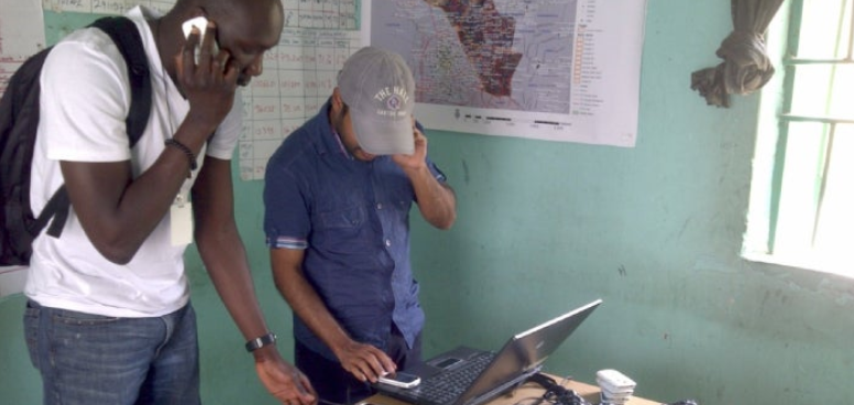
First, the authors discuss the importance of carrying out this type of socioeconomic valuation, particularly with regard to Earth-observing satellites, and reviews approaches to doing so. They then summarise the history of polio eradication efforts in Nigeria and discuss how satellite data were used to inform and support these efforts. There was, around 2011, a recognition that challenges associated with use of hand-drawn maps, including inaccurate maps and lack of tracking and accountability, were resulting in children being chronically missed by vaccinators. So, in December 2011, the National Primary Health Care Development Agency of Nigeria, along with Global Polio Eradication Initiative (GPEI) partners and the Bill and Melinda Gates Foundation, funded a project to develop geospatial information system (GIS) using recent high-resolution satellite imagery collected by DigitalGlobe (now Maxar). Researchers used manual feature extraction to identify hamlets, small settlements, and built-up areas. Field teams using Global Positioning System (GPS)-enabled phones added the settlement names and locations. The draft maps were then reviewed by ward leaders before being finalised. Initial use of the maps began in limited areas in mid-2012, and by December 2013, the GIS maps were distributed for use in 8 states, increasing efficiency and adding more than 3,000 previously unmapped settlements.
In addition to allowing experts to identify settlements that would otherwise have been missed, satellite data enabled more accurate estimates of overall growth and population size in key areas relevant to the polio vaccination effort. GPS tracking made possible by the new GIS maps also ensured that settlements were actually visited by vaccinators during the campaigns.
The authors move on to provide information and background on the data they used to carry out their analysis of population estimates and vaccination coverage focuses on Kano state. Kano is the historical epicentre of polio in Nigeria. They explain how they calculated the increase in the likelihood of halting transmission of polio associated with the use of satellite-based information compared to traditional data sources, and they consider the benefits associated with savings to the healthcare system as well as health benefits. Using a conservative approach focused on just 1 year of benefits, they estimate net socioeconomic benefits of between US$46.0 million and US$153.9 million. "Some experts even voiced concerns that a failure to eradicate polio in Nigeria in this timeframe could have led to the abandonment of the eradication effort overall....This would suggest a true socioeconomic benefit associated with the use of satellite data many times the estimate provided here."
In addition to these quantified benefits, the paper discusses qualitative benefits associated with, for example:
In August 2020, Nigeria was declared polio free. The country, which had accounted for more than half of all wildpolio virus (WPV) cases worldwide 8 years earlier, had been carrying out polio vaccine campaigns for decades but reached a turning point due to a number of interventions after 2012. One element of these interventions - and, as this article argues, a key ingredient in achieving this historic feat - relied on use of satellite data to develop more accurate maps and population estimates. This article reviews these efforts and employs a value-of-information approach to estimate the net socioeconomic benefits associated with this use of satellite data.
First, the authors discuss the importance of carrying out this type of socioeconomic valuation, particularly with regard to Earth-observing satellites, and reviews approaches to doing so. They then summarise the history of polio eradication efforts in Nigeria and discuss how satellite data were used to inform and support these efforts. There was, around 2011, a recognition that challenges associated with use of hand-drawn maps, including inaccurate maps and lack of tracking and accountability, were resulting in children being chronically missed by vaccinators. So, in December 2011, the National Primary Health Care Development Agency of Nigeria, along with Global Polio Eradication Initiative (GPEI) partners and the Bill and Melinda Gates Foundation, funded a project to develop geospatial information system (GIS) using recent high-resolution satellite imagery collected by DigitalGlobe (now Maxar). Researchers used manual feature extraction to identify hamlets, small settlements, and built-up areas. Field teams using Global Positioning System (GPS)-enabled phones added the settlement names and locations. The draft maps were then reviewed by ward leaders before being finalised. Initial use of the maps began in limited areas in mid-2012, and by December 2013, the GIS maps were distributed for use in 8 states, increasing efficiency and adding more than 3,000 previously unmapped settlements.
In addition to allowing experts to identify settlements that would otherwise have been missed, satellite data enabled more accurate estimates of overall growth and population size in key areas relevant to the polio vaccination effort. GPS tracking made possible by the new GIS maps also ensured that settlements were actually visited by vaccinators during the campaigns.
The authors move on to provide information and background on the data they used to carry out their analysis of population estimates and vaccination coverage focuses on Kano state. Kano is the historical epicentre of polio in Nigeria. They explain how they calculated the increase in the likelihood of halting transmission of polio associated with the use of satellite-based information compared to traditional data sources, and they consider the benefits associated with savings to the healthcare system as well as health benefits. Using a conservative approach focused on just 1 year of benefits, they estimate net socioeconomic benefits of between US$46.0 million and US$153.9 million. "Some experts even voiced concerns that a failure to eradicate polio in Nigeria in this timeframe could have led to the abandonment of the eradication effort overall....This would suggest a true socioeconomic benefit associated with the use of satellite data many times the estimate provided here."
In addition to these quantified benefits, the paper discusses qualitative benefits associated with, for example:
- Reaching marginalised communities: The authors describe the difficult-to-quantify benefit of the role of satellite data in helping to address inequities. "Notably, the populations that are missing from the traditional census and discovered through satellite images are typically poorer and more vulnerable than those captured by the census. The same forces that drive these individuals to the margin of society also systematically exclude them from official records like the census and the social services that census status dictates. There is value in literally 'putting on the map' these traditionally marginalized populations.
- Preventing vaccine hesitancy: With frequent oral polio vaccine (OPV) campaigns, some children may be vaccinated many times, "which can lead to confusion or even suspicion among the families involved, particularly given the lack of access to other, seemingly more immediate healthcare needs....Efficient campaigns that result in clear results in a timely manner can help to improve community trust in vaccines more generally."
- Building capacity among local populations: As part of the initial effort to create GIS maps in 2011, thousands of Nigerian health workers were trained to read and work with GIS-based maps. This has allowed them to recognise the potential applicability and value of this tool in other areas, including routine immunization activities, logistics support, broader health efforts, and non-health-related projects with a geographic component. Among the examples provided here: "researchers built on this work to create maps that helped vaccinators to reach children in terrorist-held areas in Borno, ensuring that the 2014 benefits associated with halting transmission were not lost due to security challenges....Satellite maps and population estimates originally developed for polio-related efforts have also been used to support vaccination campaigns related to measles and yellow fever..."
Source
Data & Policy (2023), 5: e16. doi:10.1017/dap.2023.12. Image credit: Gates Foundation
- Log in to post comments