


Tracking Vaccination Teams During Polio Campaigns in Northern Nigeria by Use of Geographic Information System Technology: 2013-2015
World Health Organization, or WHO (Touray, Mkanda, Tegegn, Erbeto, Banda, Vaz); Global Public Health Solutions (Nsubuga, Etsano, Shuaib)
"GIS technology, if used effectively alongside other interventions, could contribute immensely to the interruption of polio in Nigeria."
This article demonstrates the application of geographic information system (GIS) technology to track polio vaccination teams in Nigeria to monitor settlement coverage, reduce the number of missed settlements, and improve team performance. Vaccination tracking and mapping was conducted in 10 states at high risk for polio transmission (i.e., states at high risk for wild poliovirus (WPV) transmission owing to history of infection and quality of campaigns therein) in northern Nigeria (i.e., Bauchi, Borno, Jigawa, Kaduna, Kano, Kebbi, Katsina, Sokoto, Yobe, and Zamfara). Personnel at both local government area (LGA) and ward levels with extensive local knowledge were trained on field data collection. The maps generated provided the background data for the use of GIS maps for microplanning and also facilitated the tracking of vaccination team members during supplementary immunisation activities (SIAs).
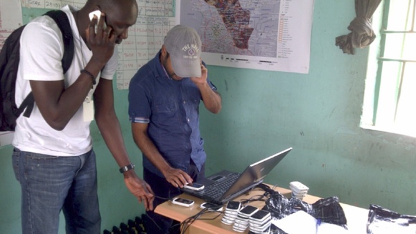
During each day of the polio campaign, global positioning system (GPS)-enabled Android phones were given to a ward focal person at LGA headquarters, who distributed the phones to vaccinators at the ward takeoff point. At the end of each day, the tracks, which were made up of data gathered automatically from the movement of vaccination teams while their GPS was turned on and provided a record of where and when they traveled, were uploaded to the local laptop at the LGA and then to the emergency operation centre (EOC)'s dashboard via a wireless router acting as a mobile wireless hot spot. The partially covered and missed settlement reports showed all settlements in which the cumulative percentage of areas visited was below a certain threshold.
Tracking activities, which started in October 2012 as a pilot, were conducted in 8 of 10 GIS-mapped states in northern Nigeria (see Table 1). During this pilot phase, from October to December 2012, 25 LGAs in Jigawa, Kano, Katsina, Sokoto, and Zamfara states were tracked. Between October 2012 and June 2015, tracking of vaccination team members covered 119 immunisation plus days (IPDs) between these states including mop-ups, which were conducted mainly in Kano state during outbreak response activities. From the missed settlements results presented in Table 2 for 2014 and 2015, there was a reduction in the number of settlements missed during polio campaigns in Kano, Kebbi, and Sokoto states. However, an increase in the number of missed settlements was recorded in Bauchi and Zamfara states during the same period. Jigawa and Katsina states also had a slight increase in the number missed. Also, in Table 2, the number of chronically missed settlements (i.e., settlements that had been consistently missed in the last 3 polio campaigns) decreased significantly for all states except Zamfara, which had a slight reduction between 2014 and 2015. In Kano state, the number of chronically missed settlements decreased from 1298 in 2014 to 165 in 2015, showing a significant drop in missed settlements.
An excerpt from the discussion section follows:
"We have demonstrated that routine tracking of vaccination teams during polio campaigns resulted in improved geographic coverage particularly in Kano, the most tracked state and the epicenter of polio transmission in northern Nigeria. Tracking of vaccination teams provided significant feedback on settlements reached or completely missed and thereby enabled supervisors to evaluate performance and missed settlements to be revisited in real time in the form of mop-up vaccinations. In addition, monitoring vaccination teams' movement through tracking made vaccinators accountable throughout the campaigns...
GIS tracking of vaccination teams has become an important monitoring tool for improving immunization coverage for the Nigeria polio program. This is because the effectiveness of immunization is best when a larger proportion of the population is protected against the disease by vaccination, through herd immunity. As long as there are significant pockets of vulnerable populations, such as chronically missed settlements, poliovirus transmission will continue to occur...
Furthermore, the outputs from vaccination tracking were used to support a number of activities in the tracked states that were relevant for polio eradication. These included the use of smart phones and tablets to locate chronically missed settlements and unnamed hamlet areas, to review microplans and align the list of settlements in the GIS database with the ward-level microplan settlement list, and to deploy other interventions in settlements that were missed and inaccessible owing to security concerns during SIAs as per the tracking results. Because of the visualization capability of the tracking system, supervisors used the coverage maps alongside the various automated reports to determine whether mop-up immunization activities were effective. Overall, we observed that improvements in settlement coverage, especially among hamlet areas, correlated with the disappearance of WPV type 1 from the state and with a significant increase in other polio program activities in Kano state. While we have shown the importance of GIS tracking of vaccination teams during polio campaigns in northern Nigeria, the use of this innovation has some limitations. First, although the tracking provides important feedback on the settlements reached by the various vaccination teams using the different reports, recording and analyzing geographic coverage does not translate into actual vaccination of children in the settlements reached...
...In conclusion, the use of GIS, as demonstrated in this study, is highly valuable in improving population immunity. It is a useful analytical tool for incorporation into health programs, especially in microplanning for polio campaigns, routine immunization, disease surveillance, and response systems..."
Best Polio Eradication Initiative (PEI) Practices in Nigeria With Support From the WHO: A Supplement to The Journal of Infectious Diseases, Guest Editors: Rui G. Vaz and Pascal Mkanda. J Infect Dis. Vol. 213, suppl 3, May 1 2016: S67-S72. Image credit: gatesnotes (the blog of Bill Gates)
- Log in to post comments